Normally, you would take Vermont Exit 3 and cross the North Royalton bridge by the Fox Stand Inn / Roma's Butchery. Because of bridge construction, use I-89 Vermont Exit 2 and go through Sharon instead.
Google Maps should route you through Sharon to the Center Royalton bridge, then up Back River Road, turning at Standing Stone Perennial Farm onto Johnson Hill Road.
Before You Head Out
📱 Cell service can become spotty as you get close to camp. Download offline maps if you can.
⛽ West Lebanon is still the best place for cheaper gas and major last-minute shopping.
🛒 Forgot something? There is now a Dollar General in South Royalton, about 4.8 miles from camp. It carries food, ice, drinks, and basic supplies, and is open 8:00 AM–10:00 PM, 7 days a week.
🧊 Buy ice before leaving town, or use Dollar General as a close backup.
🚗 The last ¼ mile is a gravel driveway. Ordinary passenger cars should be fine in normal conditions.
🌧 If the weather is unusually bad, check for any last-minute driving updates before you leave.
Route from I-89 Exit 2
Exit I-89 at Vermont Exit 2Head toward Sharon. Do not go to Exit 3 even if a map app suggests it.
After 0.2 miles, turn left on VT-132
After 0.2 miles, turn right on VT-14
After 6.8 miles, turn left on Bridge Street Fork
After 150 feet, turn left on Bridge Street
After 0.2 miles, turn right on Back River Road
After 0.8 miles, turn left on Johnson Hill RoadLook for Standing Stone Perennial Farm.
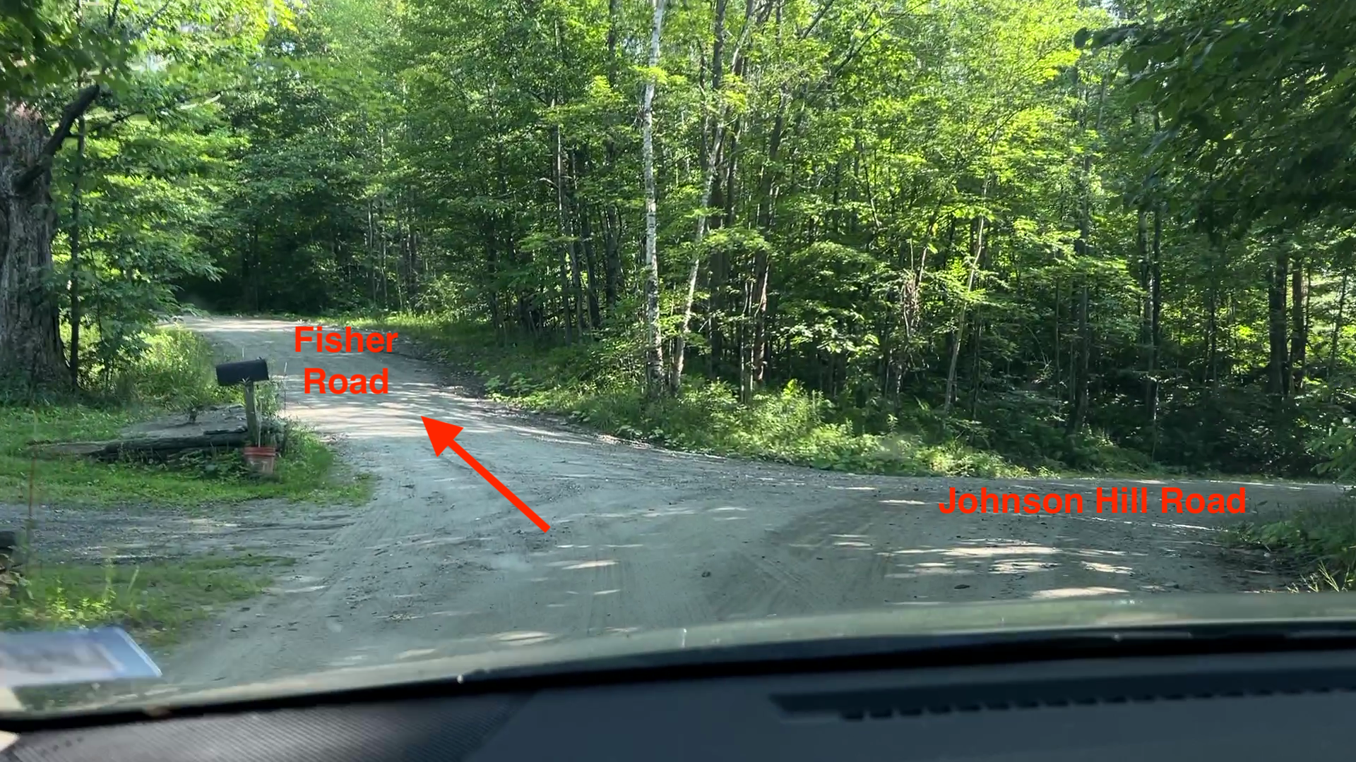
After 2.6 miles, turn left on Fisher Road
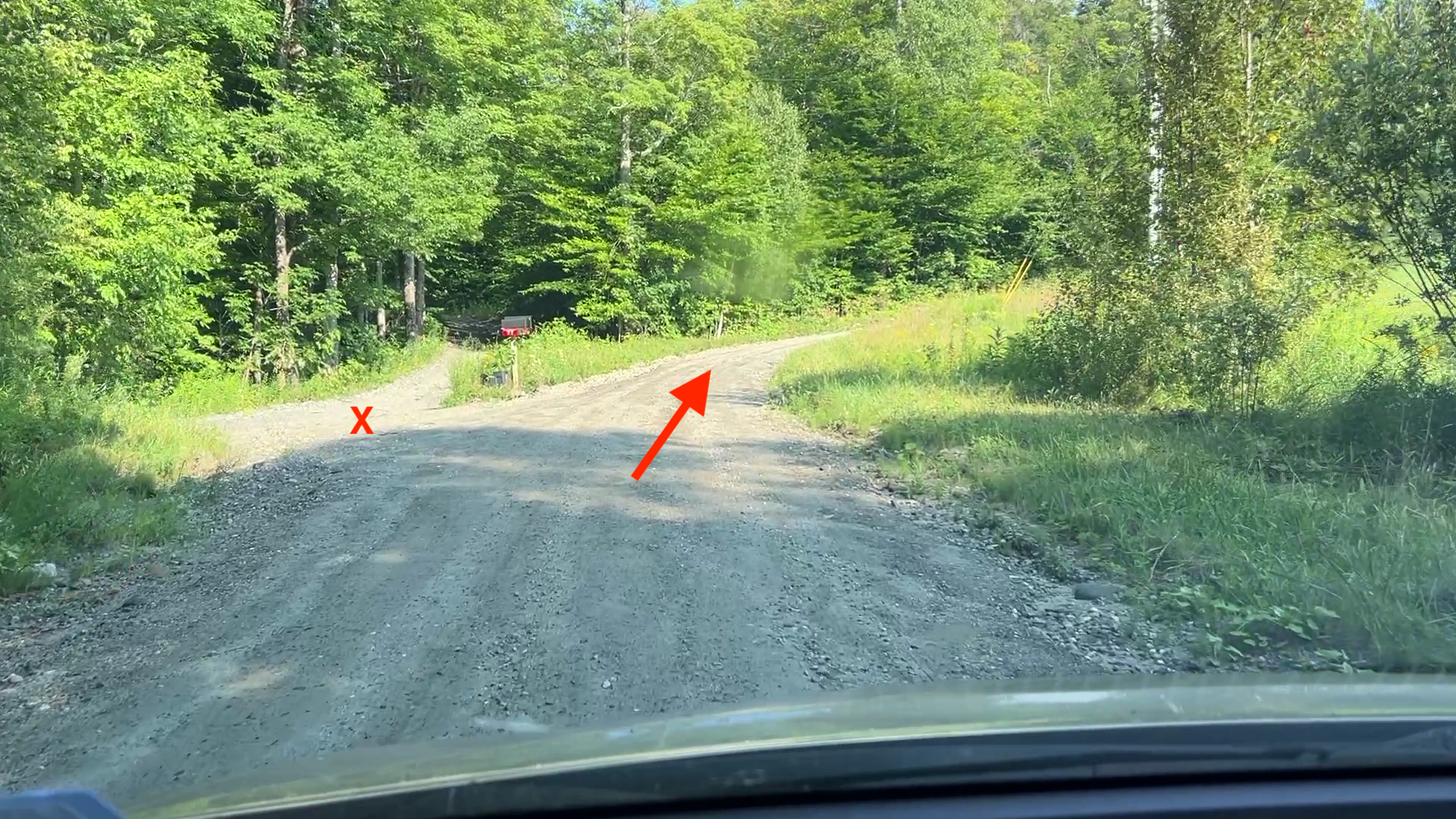
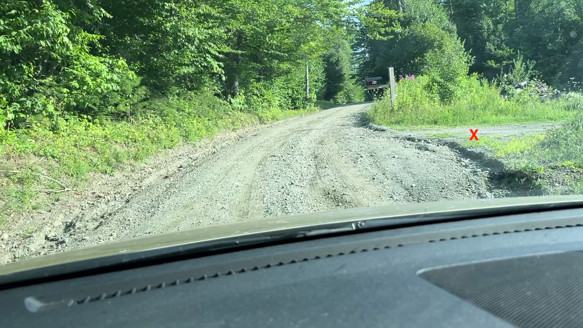
Follow Fisher Road carefullyPass the driveway on the left and stay right. Pass the house/driveway on the right and continue straight.
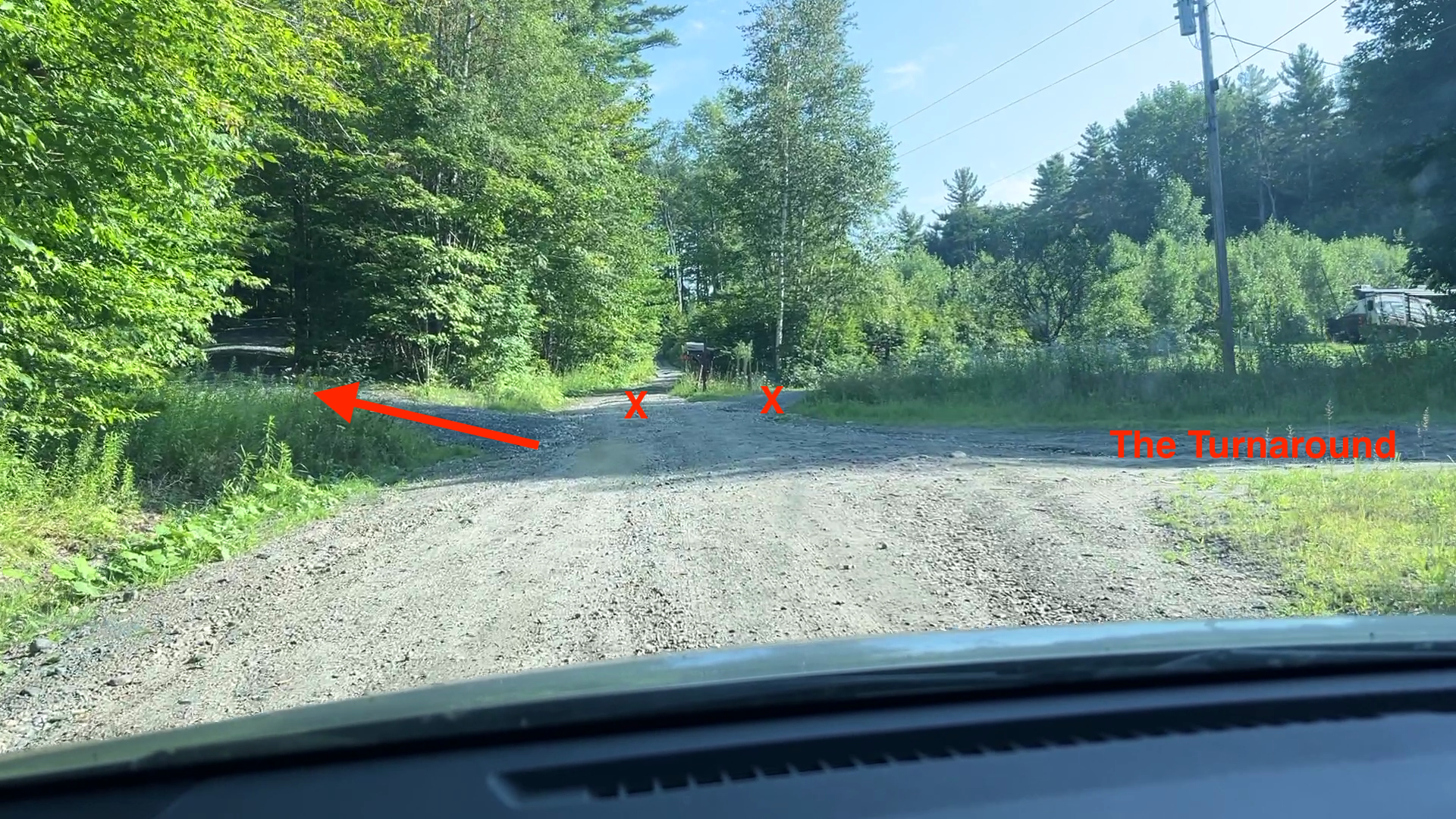
At the turnaround, take the leftmost gravel drivewayThere are three driveways in front of you. MSF is the leftmost gravel driveway, usually marked by a green canoe.
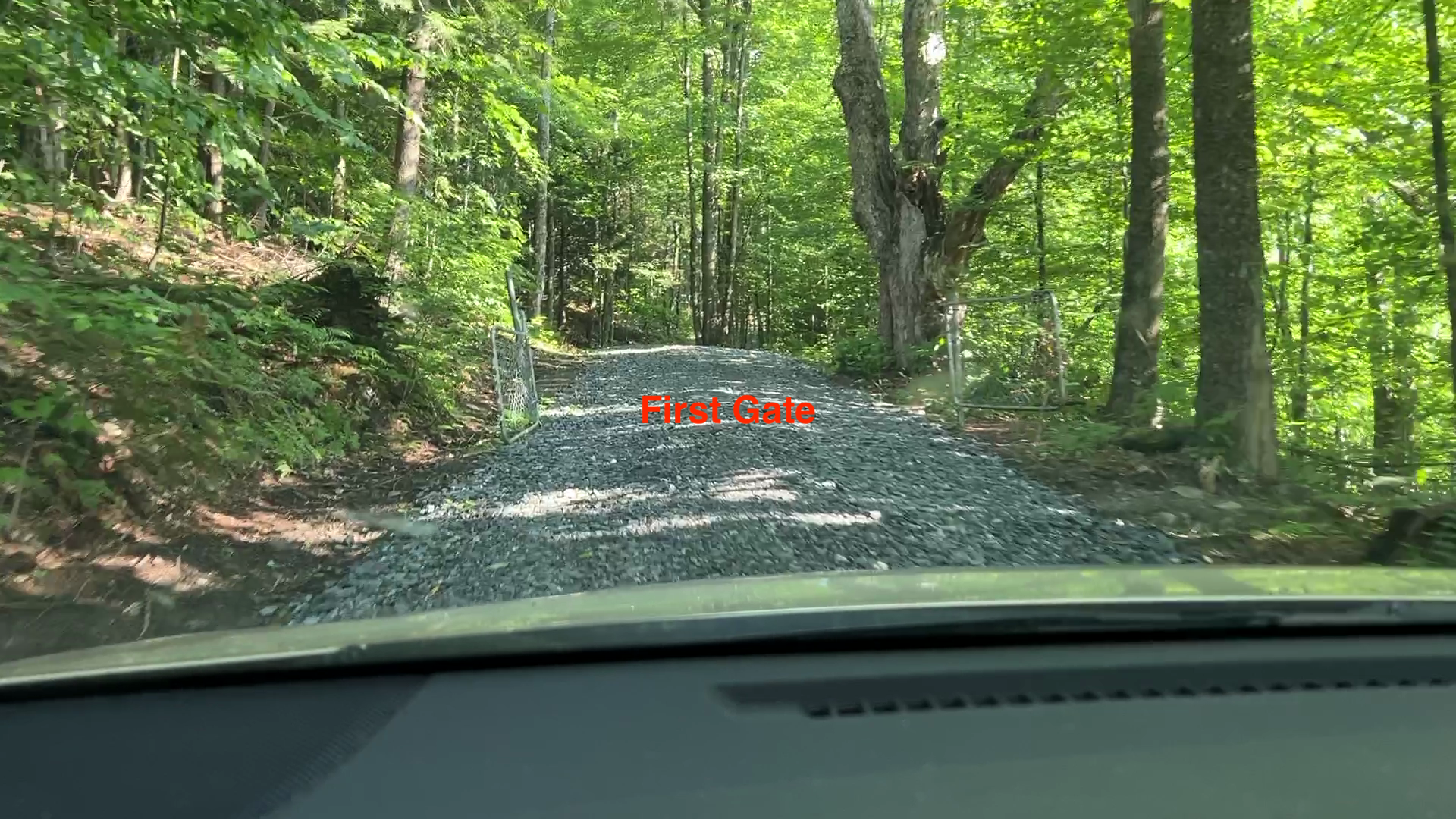
Pass through the first gateContinue up and over the hill.
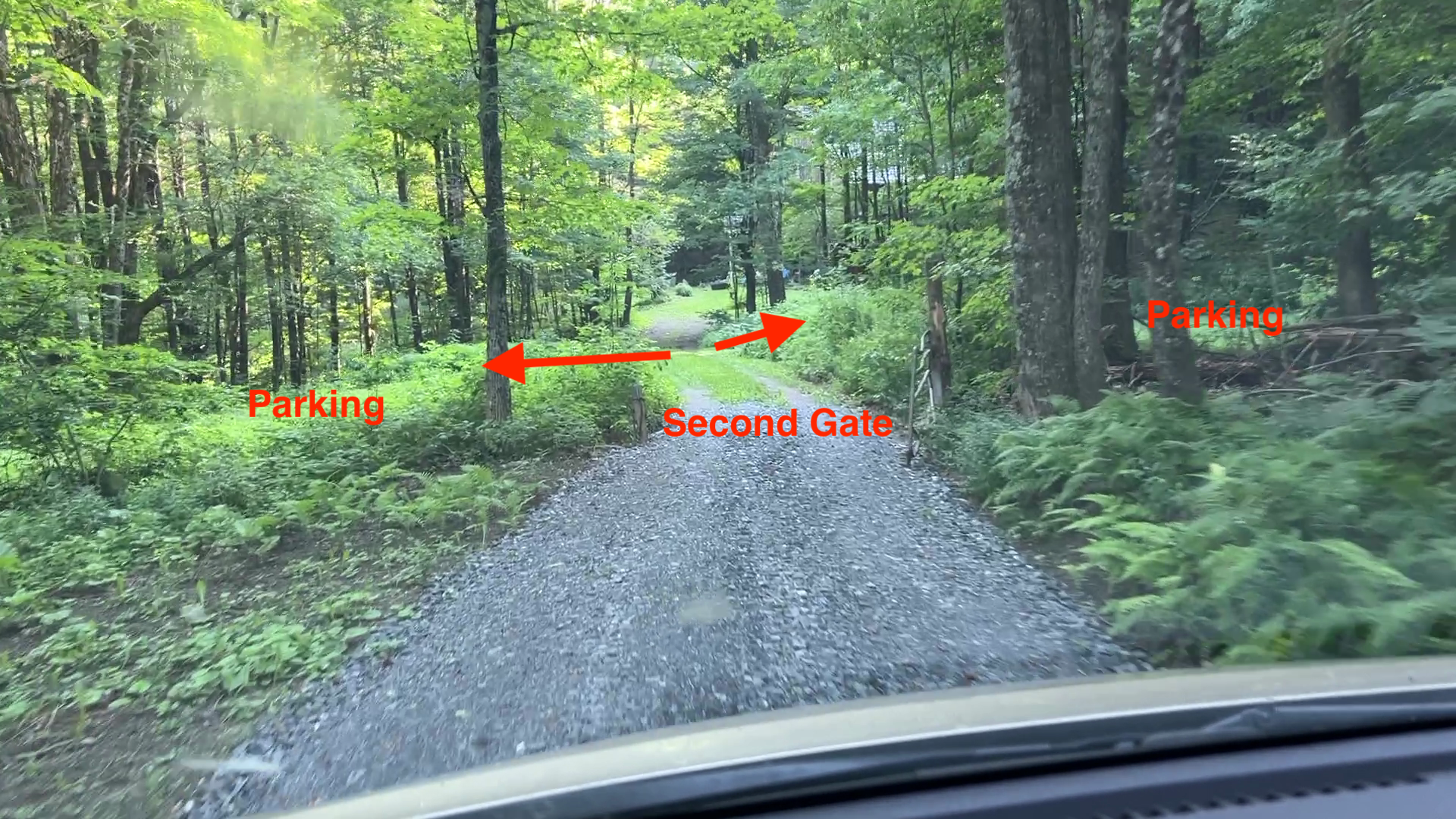
Pass through the second gateYou have arrived! Park in the grassy areas to the left or right just past the gate.
Photo Checkpoints
These photos follow the last part of the drive, starting at Johnson Hill Road and ending at the MSF parking area.
Checkpoint 1
Turn left from Johnson Hill Road onto Fisher Road
Checkpoint 2
At the first driveway, stay to the right
Checkpoint 3
Pass the house on your right and keep going
Checkpoint 4
At the turnaround, take the leftmost gravel driveway
The town road ends here. There are three driveways. MSF is the gravel driveway on the left, usually with a green canoe nearby. If you are worried about scratches or scrapes, you can park at the turnaround and walk the remaining ¼ mile.
Checkpoint 5
Pass through the first gate
Welcome!
Through the second gate: you have arrived
Please park in the grassy areas to the left or right after the gate. If you park someone else in, please leave a note on your windshield with your name and cell phone number. Then walk down the road and join the party — people will usually be at the Barn on the right, or farther down the hill by the Upper Pond and Upper Field.
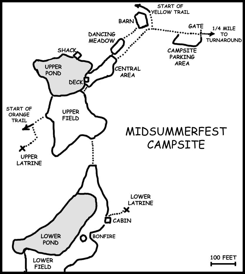
Site Map
Once you are on site, this map shows the main MSF areas.